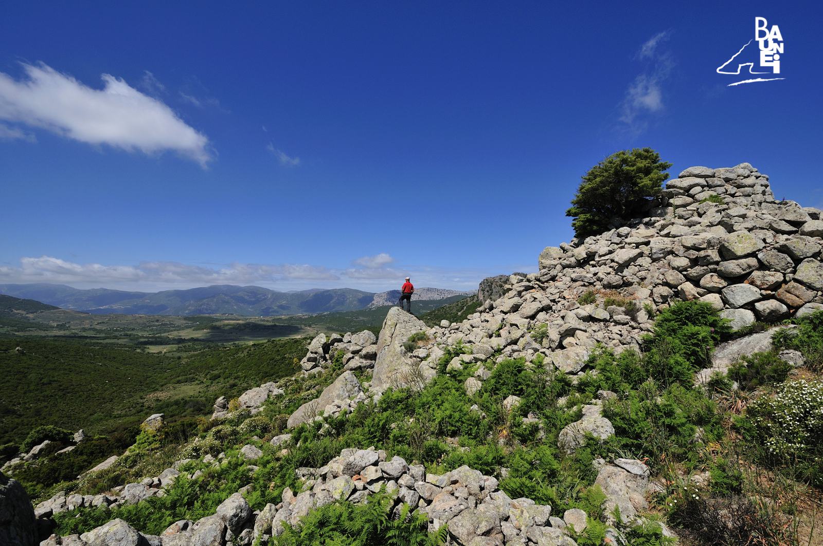
The Nuraghe “Sollùli”
On the “Margine” plateau, about twenty kilometres from Baunei, are some of the most important nuragic monuments in the territory of Baunei. One of the most interesting, and easiest to reach, stands in “Sollùli”. It is a complex type of “a tholos” nuraghe. Archaeologists use the definition “nuraghe a tholos” to refer to nuraghi built with a “false vault”, obtained by the progressive narrowing of the rows of stones (a type of construction that makes the walls gradually jut out, so that the building has an ogival section).
The nuraghe of Solluli is located at the entrance of a valley which, due to its particular geographic position (protected to the east by the “S’Abbadorgiu” peak and closed to the west by the “Serra Oseli” chain) and the presence of various perennial springs, encouraged the emergence of human settlements since the dawn of time. It is no coincidence that artefacts linked to the Nuragic civilisation dating back to the Bronze and Iron Ages were found at “Margine”. It is also no coincidence that a Nuragic spring was located at “Margine”, in a place called “Lattalài”, near “Sollùli”, where there is a channel carved in the rock, far more than 1 metre in length and still intact, which collects the water that flows from the spring. To get to the “Sollùli” nuraghe, upon leaving Baunei, take the 125 highway in a northerly direction, towards Dorgali, up until km 164,500 (just before “Genna Salbène”) and then take the dirt road on the right: after about 2 km the ruins of the nuraghe, entirely made of granite, can be found standing on a hill to the left of the road, overlooking its surroundings. Among other things, from the top of the nuraghe the peak of “Monte Scoine”, the mountain overlooking the town of Santa Maria Navarrese, is clearly visible.
Despite a number of collapses over time, the towers joined by stone ramparts are still visible. The main tower, with a truncated-conical shape, has an added section consisting of a courtyard and a tower, as well as other additional buildings of which remain parts of the stone enclosing or terracing curtain walls. The size of the complex reveals that it was a kind of fortress, whose strategic position made it capable of controlling the entrance to the Margine plateau. The particular orography of the area pushes the water from the springs towards the centre of the plain, where it stagnates, creating a marshland, in an area that is called “Sa Paùle” (“the swamp”) in Sardinian, for this very reason.
CONTATTI
Via San Nicolò, 2 – 08040 BAUNEI (Sardinia, Italy)
infopoint@turismobaunei.eu
+39 349 5462583
RELATED POST
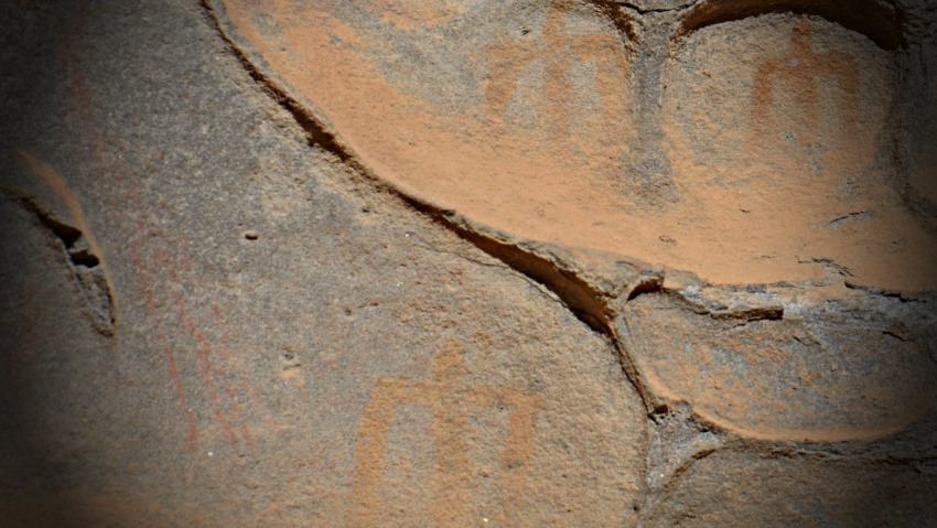
In the upland of Golgo, in Baunei, some original anthropomorphic paintings made in oxide and ochre on a rock wall have been discovered by Mr Nanni Mereu.
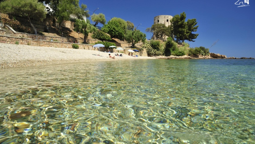
The “Central Beach” in Santa Maria Navarrese stretches from the rocks under the “Spanish Tower” to the rocks known as “di Birissi”.
“Grutta ‘e Janas’ in Sardinian means ‘cave of fairies, of witches’.